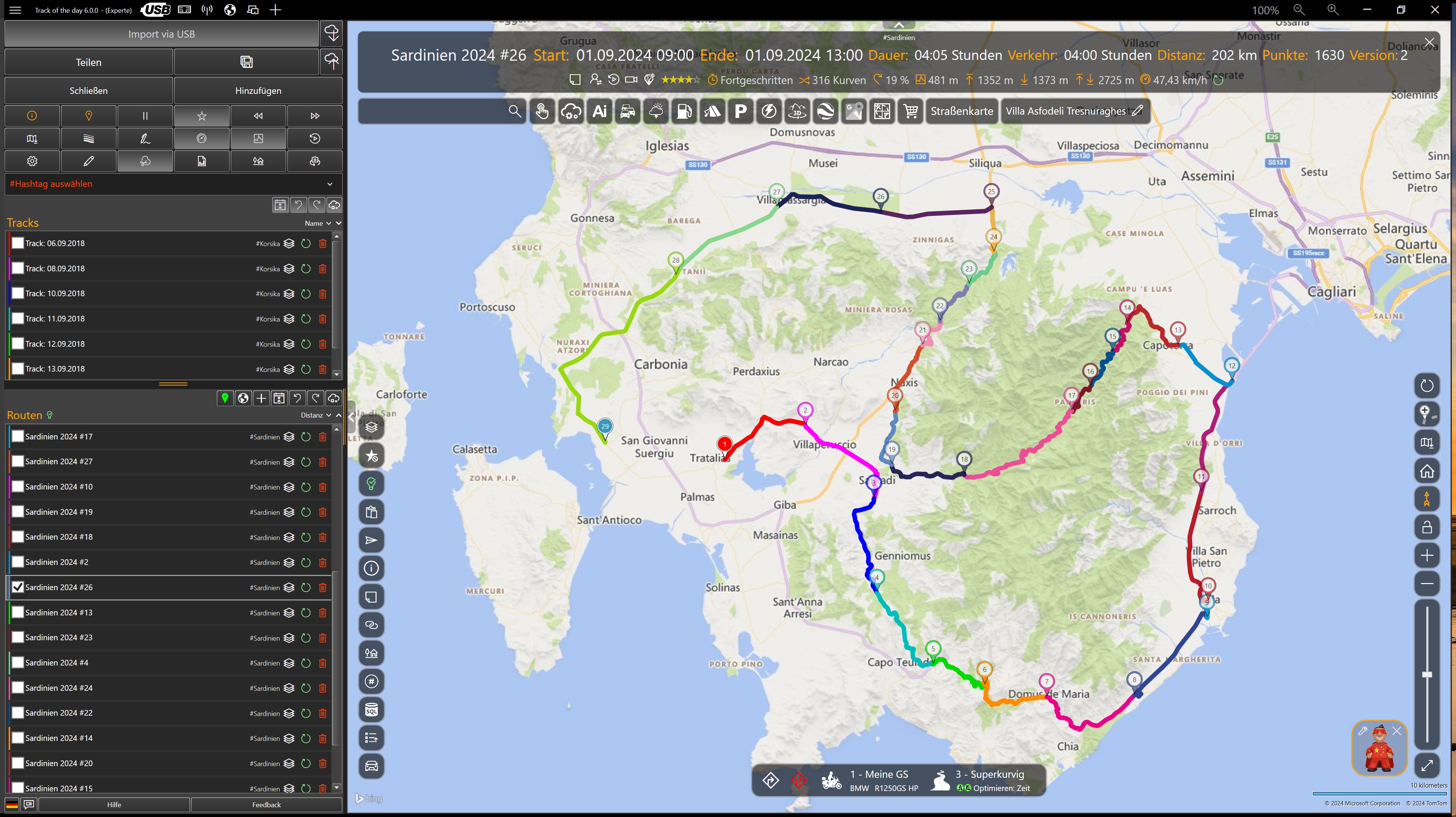
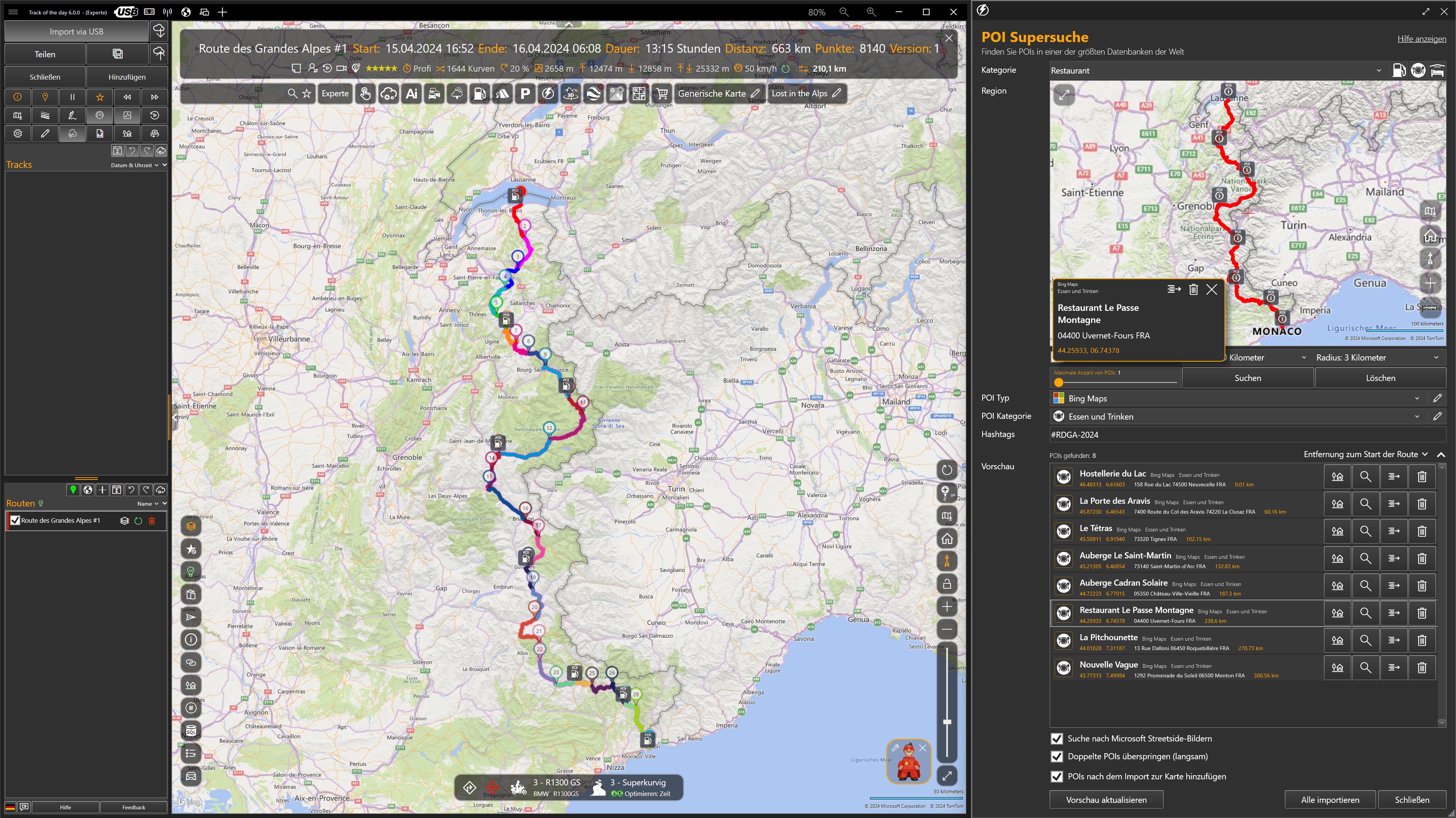
Screenshot appears after consentScreenshot appears after consentScreenshot appears after consentScreenshot appears after consentScreenshot appears after consentScreenshot appears after consentScreenshot appears after consentScreenshot appears after consentScreenshot appears after consentScreenshot appears after consent
Summary
Track of the day is a route planning app for motorcycle, bicycle, car and motorhome trips, compatible with Garmin, BMW Navigator, TomTom and Google Maps. It calculates curvy motorcycle routes and fuel-saving car routes while accounting for vehicle dimensions and warning about closures, construction, traffic, tolls and gravel or private roads. AIDEN, an AI assistant, provides travel research and generates route descriptions and roadbooks, while KAKIMOTO automatically creates varied curvy motorcycle routes and circular tours. The app integrates with Komoot, Calimoto, Kurviger and TomTom MyDrive, allowing tracks to be imported, split, reversed and converted between formats.
Show the developer's original descriptionHide the original description
Track of the day 8.2.2 is the ultimate route planner for Garmin zumo XT and XT2, BMW ConnectedRide Navigator and app, BMW Navigator VI, Scenic, Google Maps, TomTom Rider 500/550 and many other navigation devices and apps.
NEW IN VERSION 8.2
One license for the whole TD suite: a Pro license covers Track of the day, GS-Route and Track of the Day Mobile on up to 10 devices and is managed in your TD Portal account. You pair devices with a code or QR code instead of a long license key; existing keys are carried over. With "Info → Request support" you can reach support directly from the application.
NEW IN VERSION 8
No more extra installation: the database is now built right into the application. Microsoft SQL Server is no longer required. Existing data (POIs, tracks, routes, hashtags) is transferred automatically on first launch; the old SQL Server database is left untouched as a backup.
Offline maps and offline routing: download regions or the whole world map and view them without an internet connection; routing can run entirely locally if you wish. Add-on packages for terrain relief and twisty roads complete the maps.
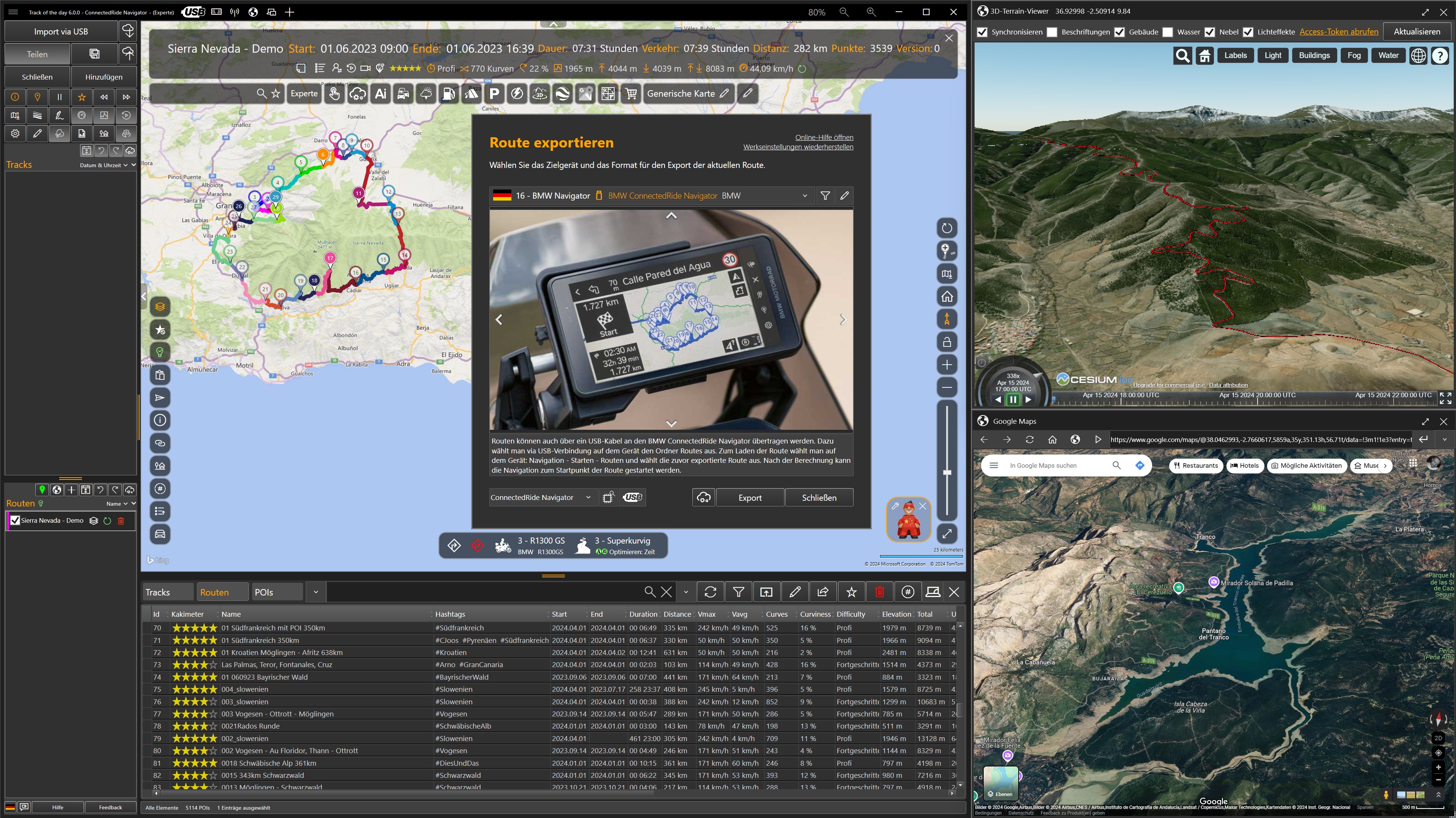
3D map: press ALT+3 to switch to the three-dimensional view with terrain relief.
Data backup: a single TDB file backs up the database, GPX files, POI images and, optionally, settings, routing profiles and garage. A database viewer with integrity check shows exactly what is in your database.
Built-in help: the help system is available in 11 languages and works completely offline (F1). An AI help assistant answers questions right inside the help.
Automatic time zone correction: track times now appear in the local time of the recording location instead of UTC, including daylight saving time.
Garmin: native GPI export with one symbol per POI, POI import directly from the connected device, shape-preserving point reduction for BaseCamp routes.
Street View coverage as a map overlay, route transfer to Track of the Day Mobile, routing profiles and garage sortable by mouse, much faster start-up and many more improvements.
THE PLANNING
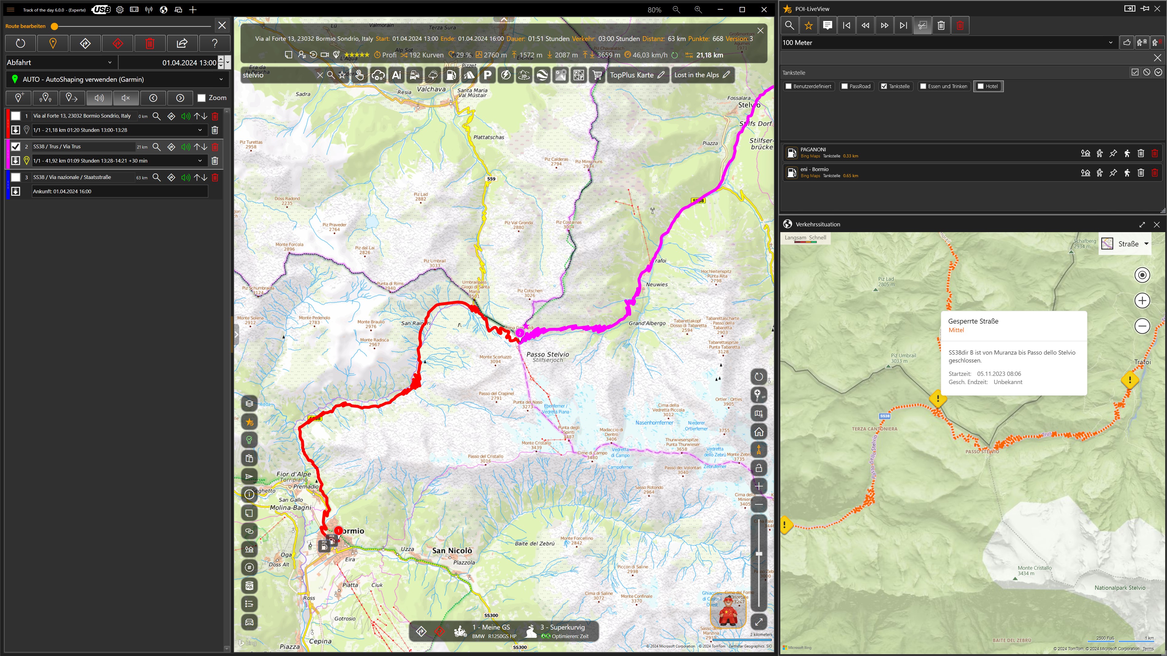
This route planner handles super-twisty motorcycle routes as well as hikes, cycling routes and fuel-saving fast routing for cars, vehicles with trailers, motorhomes and large vehicles of all kinds. Vehicle dimensions can be taken into account, and bottlenecks or low bridges avoided automatically. Warnings about closures, construction zones, traffic jams, border crossings, gravel roads, private roads and toll roads are generated automatically. Live traffic can be displayed and taken into account when routing.
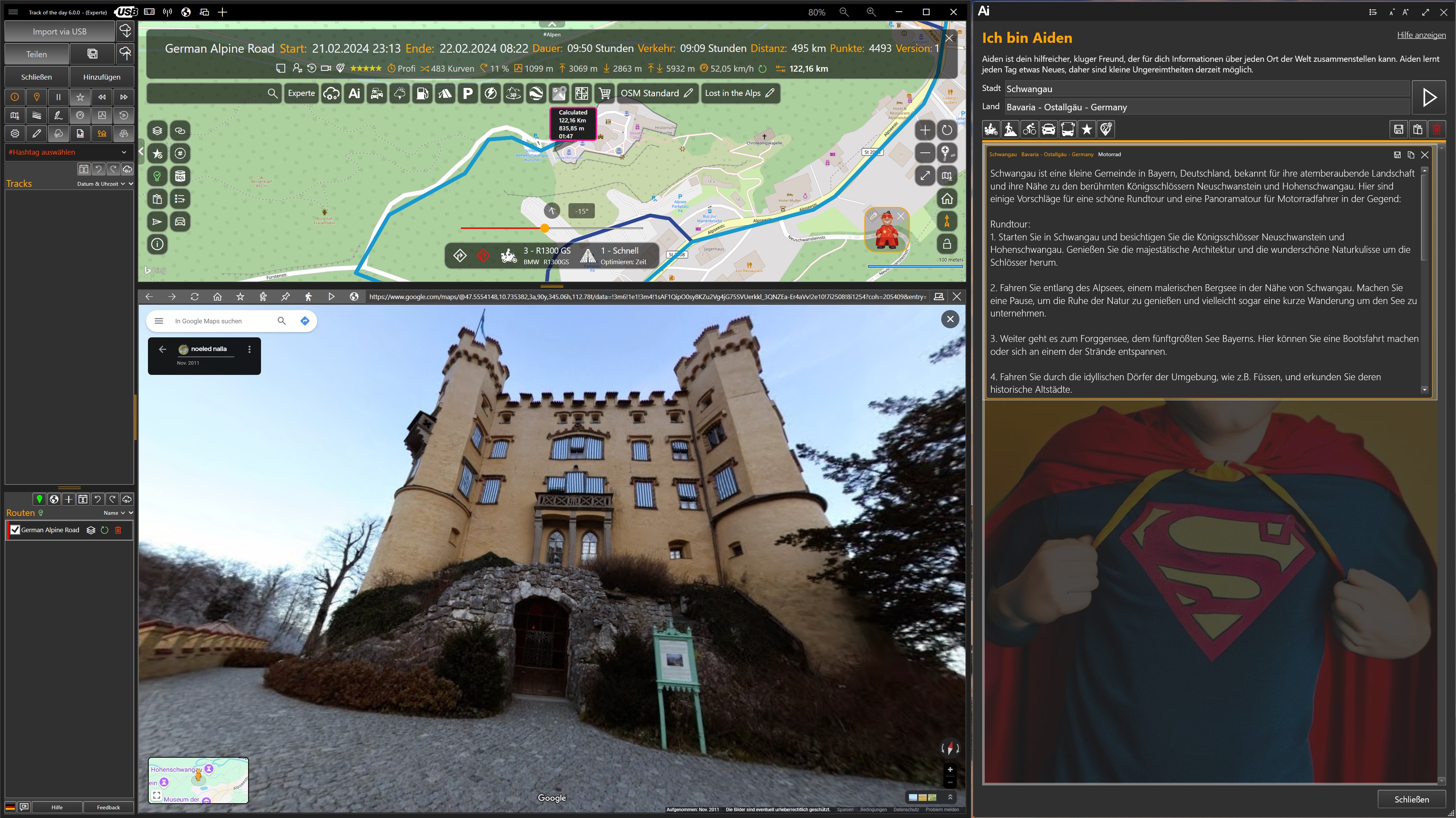
AIDEN is the AI-powered assistant for fast research and valuable travel tips. AIDEN can also automatically generate descriptions of tracks and routes as well as complete roadbooks.
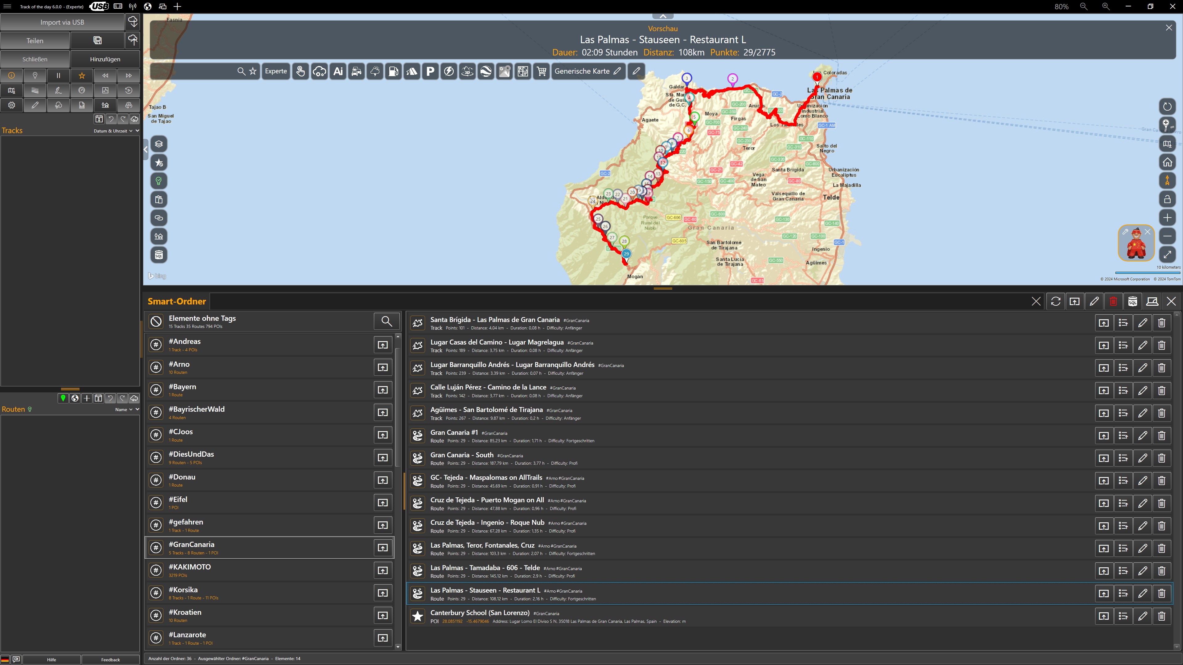
The integrated database lets you store and flexibly manage all kinds of information about future trips.
KAKIMOTO is the hard-working super-curve assistant that automatically creates ever-new variants of breathtaking motorcycle routes for enthusiasts. Round trips are easy to create too, and start and destination can even be set afterwards.
With the integrated POI and hotel search, you'll find the best POIs and the most beautiful hotels. With 'POIs along the route', fitting in overnight stays is child's play.
'ConnectedRoutes' technology keeps the routes of several days together on long journeys. With 'TraveldaySplitting', long routes are easily divided into travel days.
Besides advanced features such as 'AutoShaping' and 'AutoRouting', the integrated route planner also offers 'Follow-on routes' and 'Preceding routes'. Individual routing parameters are possible for every section of a route. A relaxed highway ride there and back, carving corners with friends, and a hike to a viewpoint in between – no problem at all. Adventurous off-route trips can be planned without any restrictions, too. Where the known paths end, straight-line navigation is also possible.
Routes of any length are possible too, such as the Panamericana there and back.
Thanks to the integration of Komoot, MRA, Calimoto, Kurviger, TomTom MyDrive and many other route planners, ready-made tours can be imported and processed with a single click. Plan with Kurviger or Calimoto, navigate with TomTom, Garmin or BMW Navigator – anything is possible. Using Komoot without a subscription with free navigation is no problem either.
Tracks from all integrated route planners can be freely split, merged, reversed, converted into routes and much more.
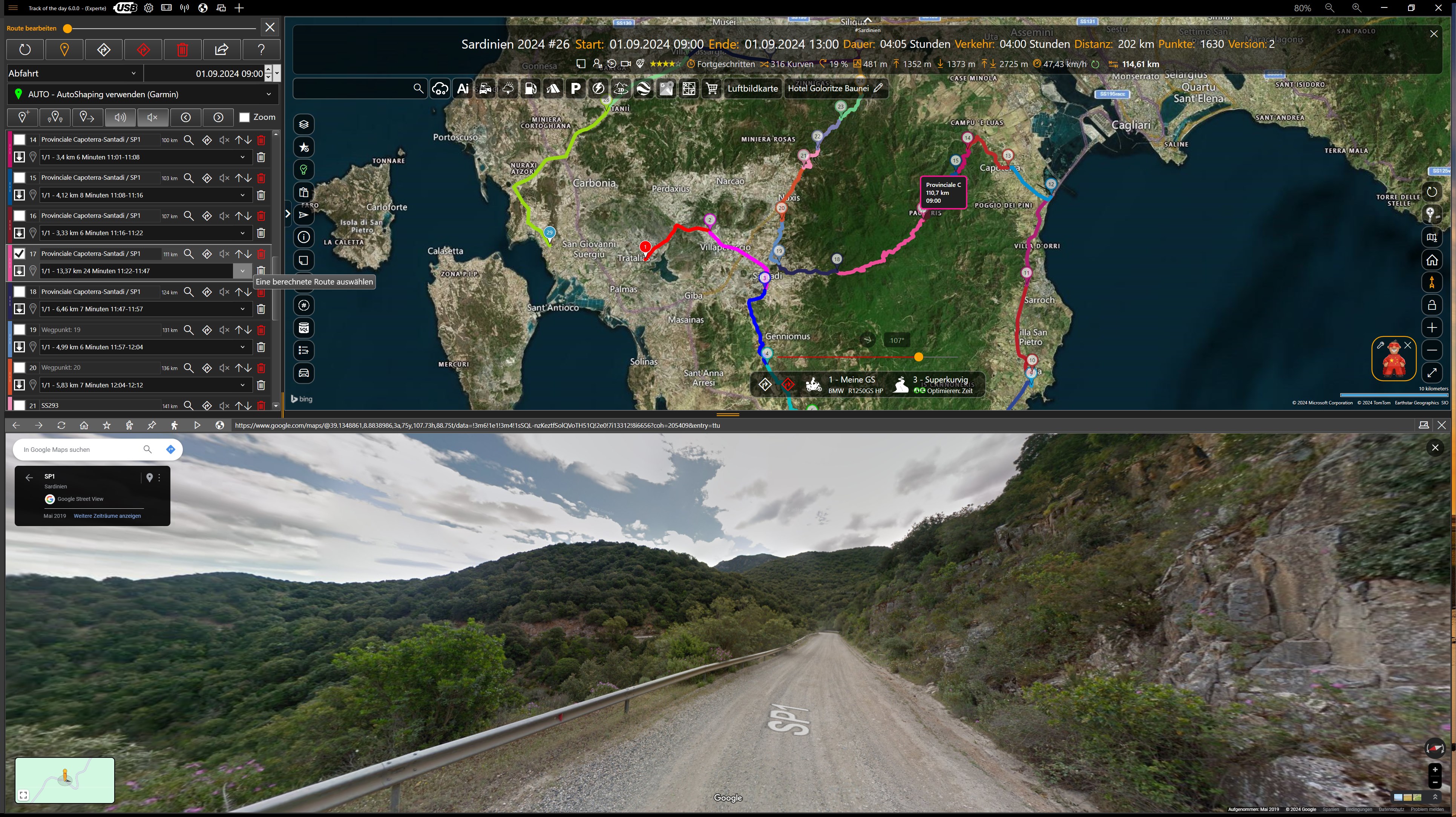
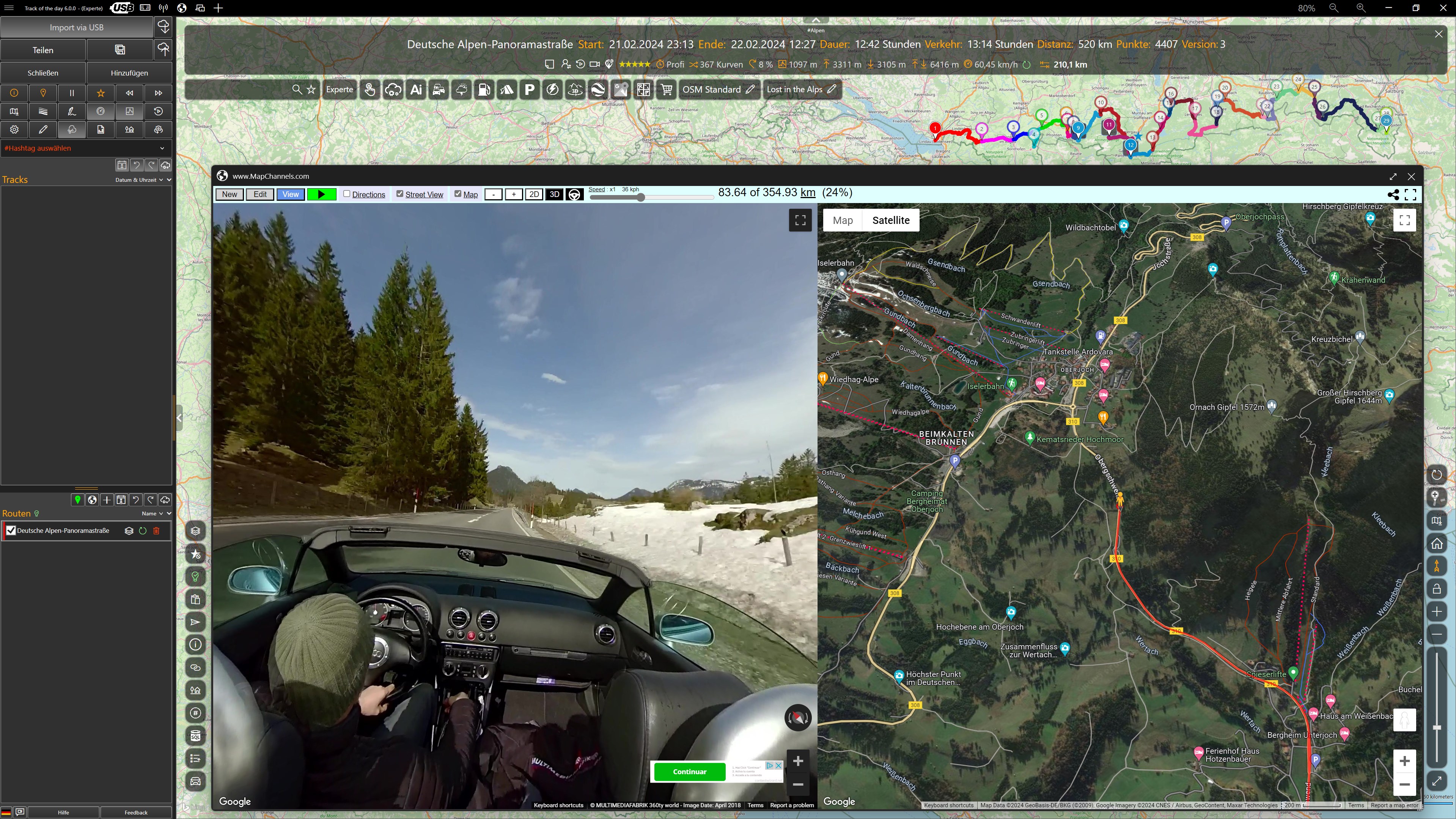
Route planning has never been so efficient and easy. While you plan, Google Street View lets you experience what awaits you on a route. Meanwhile, 'RouteMetrics' calculates key parameters such as fun factor, curviness and elevation profile fully automatically in the background.
MAPS
There is no need to buy expensive map material for this application. More than 30 map views from HERE, Azure Maps, Google, OpenStreetMap and other providers are available, plus weather and traffic maps. All online maps are continuously updated by the providers and are available in many languages; most map views are fully customizable. A local cache for map data can be enabled at any time, and offline maps make you independent of the internet.
ANALYSIS AND VIDEO
Tracks and routes can be sorted by name, date, distance, riding time, speed, altitude and more at any time. With one click, tracks are automatically colored by altitude or speed. The analysis shows elevation profile, speed profile and other exciting evaluations. All evaluations can be saved separately as 300 dpi graphics.
Importing geotagged photos and converting them automatically into POIs is extremely easy: simply drag and drop photos from Windows Explorer to import them as POIs.
With the Street View integration, you can virtually experience all tracks and routes in the direction of travel. With just one click, tracks and routes become animated MP4 videos, with a virtual cockpit visualizing distance, time, speed, altitude and heading. You can also play your own photos and Google Street View images as a slideshow.
Fuel stops and small detours are easily corrected with the integrated track editor. Tracks can also be anonymized.
EXPORT
When exporting routes, the limitations of the connected devices are taken into account automatically. If desired, the POIs of the current map view can be embedded in routes on export and displayed on navigation devices.
Import and export of unencrypted POIs is supported for many TomTom and Garmin devices and the BMW Navigator series. POIs can be exchanged between devices from different manufacturers at any time.
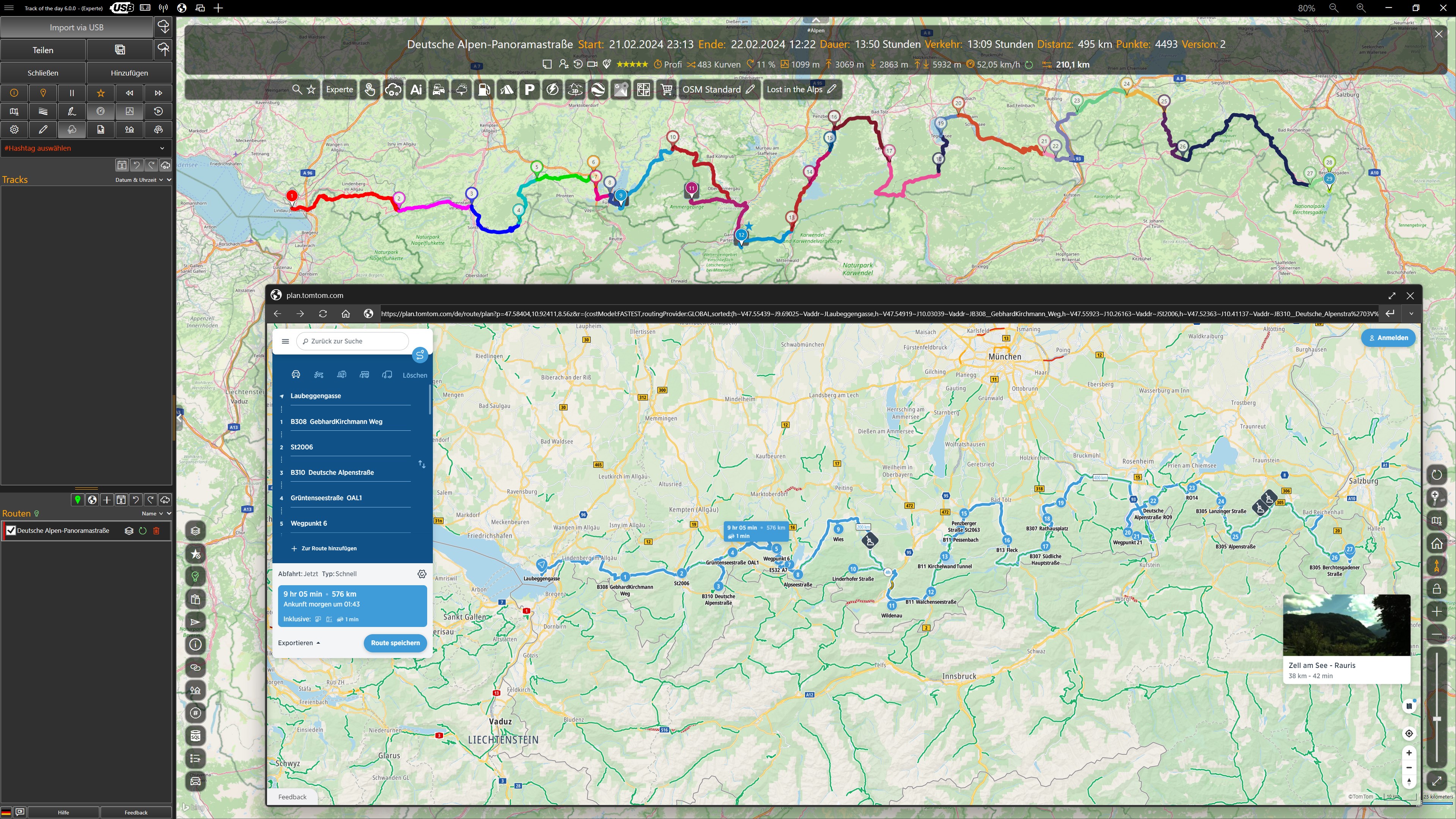
TomTom users can transfer all routes to their devices in GPX or ITN format. Via the TomTom MyDrive integration, multi-stop routes can be sent directly to TomTom devices.
All routes can also be opened in Google Maps and sent straight to a smartphone. Importing routes from Google Maps is supported as well. Places saved in Google Maps can be imported as POIs at any time.
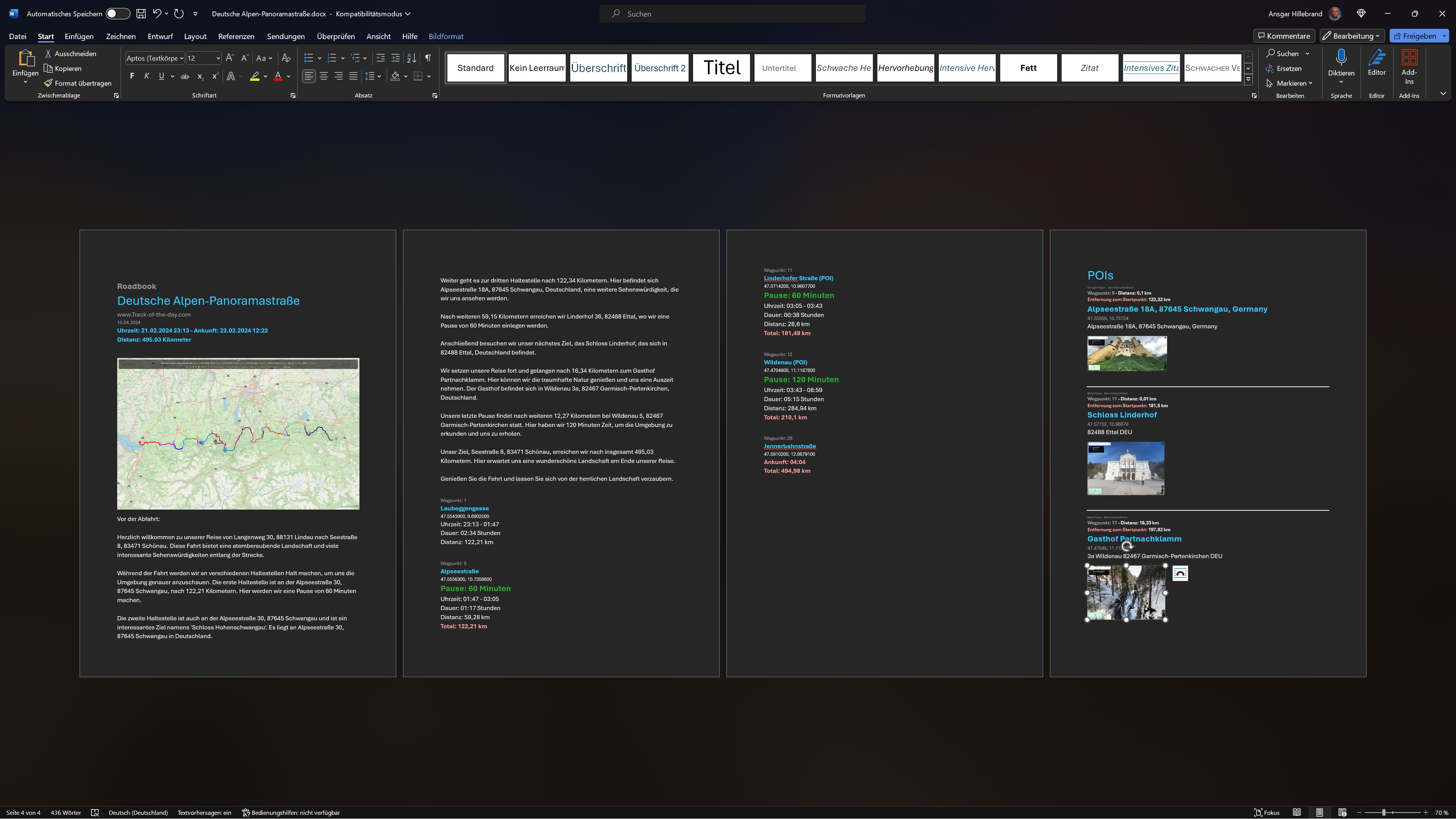
With just one click, the DOCX generator turns complex routes into a practical roadbook in DOCX format that can be edited and printed with Microsoft Word and compatible programs. Photos from all POIs are included automatically. Tables can also be exported in XLSX format for Microsoft Excel and compatible programs.
FREE AND PRO
Free Pro Features
✓ ✓ Over 30 map styles
✓ ✓ Google Street View
✓ ✓ Google Maps
✓ ✓ Google Earth
✓ ✓ 3D map with terrain relief
✗ ✓ 3D aerial view
✗ ✓ OSM Outdoor
✓ ✓ Weather maps
✓ ✓ Offline maps
✓ ✓ Offline mode
✓ ✓ Itinerary
✓ ✓ Routing warnings
✓ ✓ Garage & routing profiles
✓ ✓ MRA, Calimoto, Kurviger, Komoot
✓ ✓ Wikiloc
✓ ✓ Overpass Turbo
✓ ✓ Import of geotagged photos
✓ ✓ Apple iCloud integration
✓ ✓ Import of vCards (vcf)
✓ ✓ Import of tracks
✓ ✓ Create a route
✓ ✓ Create many routes
✓ ✓ Convert track – route
✓ ✓ Convert all tracks
✓ ✓ Convert all routes
✗ ✓ Sharing via TD-Cloud
✗ ✓ AI features
✗ ✓ AI roadbooks
✓ ✓ Export one route
✓ ✓ Export all routes
✓ ✓ Scenic export
✓ ✓ Open routes in Google Maps
✓ ✓ Open routes in TomTom Plan
✓ ✓ Open routes in Kurviger.de
✓ ✓ Import database content
✓ ✓ Export database content
✓ ✓ Open tracks from database
✓ ✓ Open routes from database
✓ ✓ Quick route creation
✓ ✓ Split tracks
✓ ✓ Reverse tracks
✓ ✓ Reverse routes
✓ ✓ Duplicate tracks
✓ ✓ Duplicate routes
✓ ✓ Calculate elevation profile
✗ ✓ Generate round trips
✓ ✓ Reduce track points
✓ ✓ Track analysis
✓ ✗ Videos with watermark
✗ ✓ Videos without watermark
✓ ✓ Save tracks in database
✓ ✓ Save routes in database
✓ ✓ POI super search
✓ ✓ Travel tips
✓ ✓ POI-LiveView
✓ ✓ Define regions
✓ ✓ Routing overlays
✓ ✓ POI export
✓ ✓ KAKIMOTO
Pro licenses compared:
7 days - 0,00 € *
30 days - 9,99 € *
365 days - 49,90 € *
* All prices include statutory value-added tax (VAT).
A Pro license covers the whole TD suite (Track of the day, GS-Route, Track of the Day Mobile) on up to 10 devices. The purchase does NOT include a subscription. When the license expires, you automatically return to the free Free Edition until you upgrade to the Pro Edition with a new license.
If there is a version of this app for iOS/Mac or Windows we don't know about, paste the store link here — we'll auto-detect the store.
How to find the URL:1. Open the app in its store. 2.In the App Store app: tap the Share icon → “Copy Link”. In the browser: copy the URL from the address bar — it contains apps.apple.com/…/id… or apps.microsoft.com/detail/…. 3. Paste it here.
Paste the original link from the Apple App Store or Microsoft Store. We fetch all details automatically.
How to find the URL:
1. Open the app in its store. 2.In the App Store app: tap the Share icon → “Copy Link”. In the browser: copy the URL from the address bar — it contains apps.apple.com/…/id… or apps.microsoft.com/detail/…. 3. Paste it here.
Android apps can only be listed by their developer.



 Any Distance Running Tracker
Workout tracker for running, hiking and cycling with maps
 adidas Running: Run tracker
Running training with adaptive plans and activity tracking
 Strava: Run, Bike, Walk
Log workouts and share with friends
 Google Maps
Navigation, route planning and place search with live
 GPS Tracks
GPS tracking for hiking, biking and offline navigation
 Map My Fitness Workout Tracker
Track, plan and analyze workouts with progress monitoring